
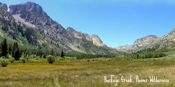
Backpacking Buckeye Creek, Hoover Wilderness
A couple of firsts this 4th of July weekend – My first backpacking trip of 2013 and Curtis & I’s first backpacking trip in the Hoover Wilderness! I choose this trip out of Exploring Eastern Sierra Canyons: Sonora Pass to Pine Creek, which I recently found and bought a copy of in the Groveland Museum (which I was surprised to see has the best selection of regional hiking books and guides, well worth a stop). My criteria for this hike was: 3 days in length, not too steep on the downhill grade since I did not want to injure myself before my half marathon this weekend, and preferably taking away from the 4th of July crowds. I am glad to report Buckeye Creek delivered on all of these points, and offered some amazing views – albeit with a few more cows and mosquitoes than we would have preferred.

Trip route – day one is the red line, day two the pink, day three the yellow. Totaling a little less than 30 miles long, if we would have staged a second car at the Twin Lakes trailhead this hike would have only been about 20 miles in length. Click to enlarge.
Day 1: Backpacking Buckeye Creek
Trailhead: Turn onto Twin Lakes rd from Hwy 395 near the town of Bridgeport (allegedly there are good fireworks in Bridgeport if you are coming here on the 4th of July although we were 1 day too late). After passing the cow pastures turn onto Buckeye Road on the right and follow this dirt road (small/low clearance car friendly) all the way to the Buckeye Campground at the end. At the end of the campground is the trail head, we parked near the wilderness informational sign. Click here for a map.
Distance: about 8 miles on day one, 6 or 7 of which are in a flat meadow before your reach the Wilderness.
Curtis and I did not get a super early start on the trail (about 12:30 in the afternoon), but luckily we did manage to roll through the whole of Yosemite and Tioga Pass before the majority of the crowds had started their day. You do need a backpacking permit for hiking in the Hoover Wilderness, which we picked up from the Bridgeport Ranger Station, but our ranger informed us the Buckeye Creek Trail does not have a quotas on the number of backpackers. Even if there was a quota in place we only met horseback riders who were visiting the Big Meadow for the day and turning around.
After reaching the bend in the canyon the gentle hill landscape disappears and in it place you get to view the more dramatic and rugged sierra landscape you are hiking towards.
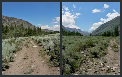
The first couple miles of the trail are sandy, as is normal on trails with appreciable amounts of horse traffic, but not as extremely dusty as our trip out of Kennedy Meadows Pack Station in the Emigrant Wilderness. For the most part it seems like horseback riders go up to the bend in the Canyon, allowing them to the view the Sierra mountains, and then turn around. What I wasn’t expecting was the cow traffic – So Many Cows. After the sandy stretch of trail the path is littered with cow pies and wanders among large herds and small little groups of cattle. Apparently this is common in the meadow in mid-summer, we crossing the trail in the middle of a rancher releasing more cattle onto the meadow. Because of the cattle we ended up crossing the river higher upstream than the trail traditionally does, which was an adventure that made me happy for my sandals.
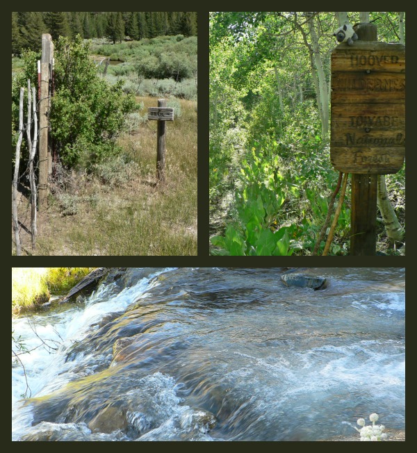
After the river crossing the trail becomes increasingly harder to find, melding with cow paths and sometimes disappearing into the meadow. Eventually we reached a very homemade fence and gate, with a trail sign that lead us into the higher meadow where the cows had not yet been this summer. Here the trail started to become more enjoyable, weaving through aspen stands and following barely discernible paths up the canyon. We had to make a few haired judgement calls here, sticking to the right side of the canyon and following up an overgrown & forested path. Luckily this lead us to the Hoover wilderness sign – indicating we were both on the correct path & that we had little risk of running into too many people on this apparently minimally used trail.
Day one on the Trail: Can you spot the trail in these 3 locations?
We headed uphill until we reached creek crossing, deciding to camp in a small flat next to some aspens, with an open view of the canyon we had just walked up. Above the cows and with enough wind to keep the mosquitoes at a minimum we were able to enjoy watching the stars come up over us. I am not certain our elevation, but it never became too cold either night we were camped.
Day 2: Backpacking up the Roughs, and hiking up to Buckeye Pass & Yosemite
Distance: 10-ish miles total. ~1.5 miles from campsite to trail fork, 8.5 miles out and pack to the pass, and then back down the trail until we found an acceptable campsite.
The section of trail above the meadow is called “The Roughs” on the map, I would guess because this landscape seems rough compared to the meadow before it. This area is (in my opinion) the most beautiful section of the hike, which is why we camped this second evening. But, because I am a destination oriented hiker I was determined to reach the rarely visited Buckeye Pass and eat my lunch in Yosemite.
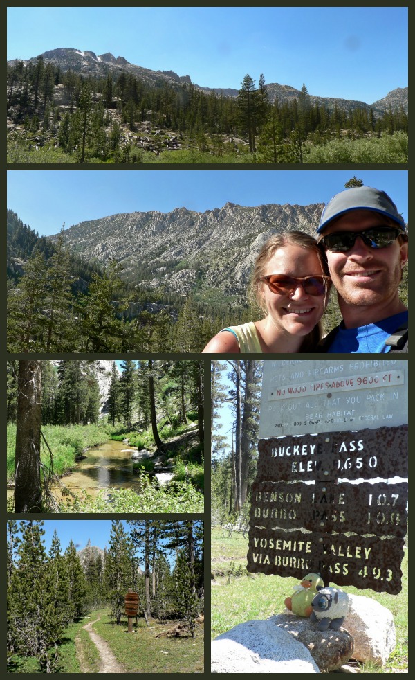
Buckeye Pass, Yosemite National Park,along with a picture of Buckeye Creek as we made the hike up.
We left our packs behind at the abandoned cabin near the trail forks and headed up the trail with minimal weight, hurrying away from the swarms of mosquitoes. The hike up to Buckeye Pass is never too steep, and as such never provides any earth shattering views of the Sierra on the way up or on the pass. On the plus side this section of trail is less overgrown than down near Buckeye Creek Canyon, and the distances on the Tom Harrison Hoover Wilderness Map is surprisingly accurate. We made it to the pass just before our “Give up and turn around” time, and had a quick lunch among the rabid Yosemite mosquitoes.
We camped that night on a granite ledge above the creek just south of where we left our packs. Moving higher up we were able to escape the worst of the mosquitoes that night, and see an array of song birds – plus one adorable hummingbird!
Day 3: Backpacking down to the trailhead
Distance: 9.5-ish miles
As is the nature of out and back hikes the final day was spent retracing our steps from day one. We enjoyed our last crossing of high sierra (cow-pie free) water at the same creek we camped near the first night and started down to the meadow. I was super happy with how brief the decent downhill was on this trail, allowing us to not stress our knees too much. Before we knew it we could once again hear the distant moo of cows, and came to find even more (dozens? Hundreds? hard to say…) cows in the meadow than we had the first time. I would like to say that a fall time visit to Buckeye Creek would be beautiful because of the Aspen here, but in all honesty if these cows continue up meadow all summer then it might be a less fun hike.
By the time we made it back down to the car we had not seen another person for over 2 days. Which is pretty impressive for the 4th of July weekend.
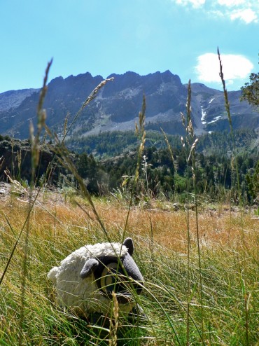
We did not mark this sheep as “Stock” on our permit.
Overall I enjoyed our Buckeye Creek backpacking trip – Recommendable if you want to get away from the hustle without too steep of a climb, and don’t mind cattle. More pictures in the gallery below.


 Hello! I am a 30-something outdoors-lady, backpacker, and resident of Groveland, California -
Follow Me: