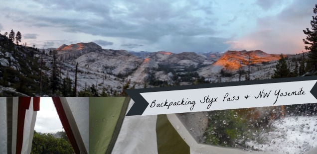
Backpacking Styx Pass: A Hidden Granite Wonderland in Northwest Yosemite & Emigrant Wilderness
Normally Memorial Day weekend backpacking trips in the Sierra are more like winter camping than a leisurely summer trip – and to my surprise the Sierra gave the whole winter thing a solid try on this backpacking trip up to the Northwest boundary of Yosemite and Cherry Creek Area. We camped out beneath rain, hail, thunder, and beautiful clouds. Never underestimate the power of the weather in the Mountains, even during the drought.
Inclimate weather can affect spirits, or be downright dangerous, if you are not prepared – but the payoffs are amazing sunsets plus the chance to start the Backpacking season early during on this three day weekend.

Three Day Backpacking Trip To Styx Pass & Boundry Lake – Yosemite National Park & Stanislaus National Forest
Trailhead: From Hwy 120 travel 14 miles East of Groveland and turn Left down Cherry Lake Road just after the bridge past Rainbow pools. Follow the winding cherry lake road for 23 miles until arriving at Cherry Lake. In the warmer months you can drive across the Cherry Lake Dam and up road 1N04 until the road dead ends at the Single Springs Trailhead. It does get a little rough, but the Sable (a passenger car) made it! Beware that in the winter months the road over the dam closes. Map (Use at your own risk: Google maps IS NOT accurate in this area. To obtain a wilderness permit to Styx Pass you will need to stop that the Groveland Ranger station to get one anyhow, I suggest you save some heartache and ask for directions)
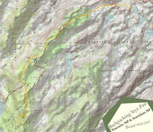
Distance: 30 miles total round trip (GPS track data). To Styx Pass it was 11 miles, and then another 4 the next day down to Boundary Lake. The trail is not steep per se, but the fires here have resulted in a number of downed trees which significantly slowed pace our pace.

Click through to see a more detailed Topo map of our two day hike (day three was simply back all 15 miles). Yellow line is day 1, orange day 2. North is up.
Arriving to the trailhead after the long drive to Cherry Lake from Groveland (such a windy road) Curtis and I had all of 20 minutes of light mist to enjoy the minimal views on Kibbie Ridge of Cherry lake and the Kibbie/Rim fires before a dense grey fog enveloped our hike. Honestly the first stretch, about 8 miles, are not the most action packed even when you can see further than 4 feet out. But still, as I found out on the walk back on sunny day 3 of our trip – there are nice views of Cherry Lake near the trailhead, rare glimpses into what looks to be a nearly inaccessible Upper Cherry Creek canyon, and the occasional sign reminding you you are either in Yosemite or in the Emigrant Wilderness.
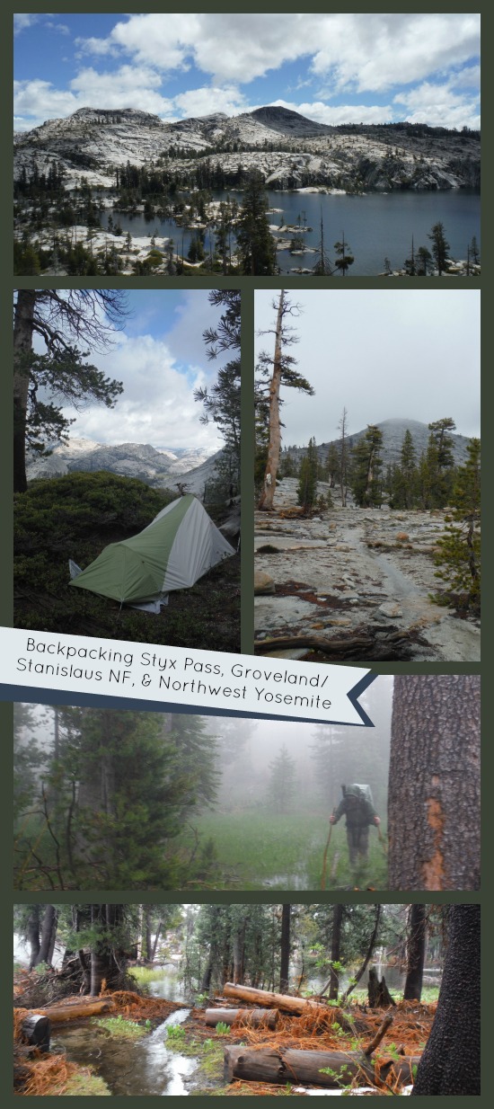
Additionally, be aware that this trail gets super wet – including a few saturated meadow crossings on sinking logs, and essentially walking on a stream of trail near the Sanche Springs area and beyond. But once you do get past Sanche Springs the granite opens up, the mountains fall into place through the fog, the heavens will temporarily open up for a beam of sunlight…. you will momentarily forget how wet you really are. This northwestern intersection between the Emigrant Wilderness and the Yosemite wilderness is a real hidden gem. And while it has been discovered by some, there are not nearly the crowds one might expect given the beauty. My recommendation is to go now, before backpacker magazine profiles the hike!

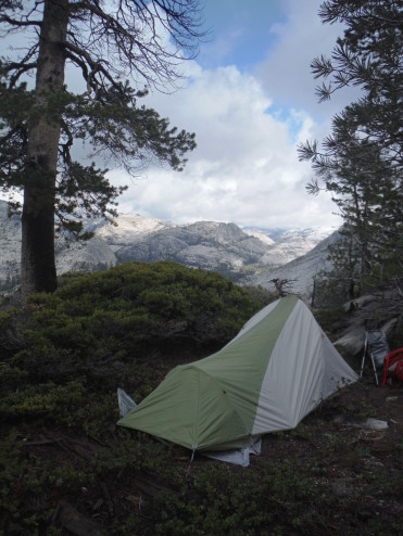
Camp Near Styx Pass, Stanislaus National Forest – Groveland (!) Ranger District. During a brief moment of sunlight in which we set up the tent.
Day 1 we decided to set up camp near a seasonal (?) creek beyond Styx Pass but still inside the Forest boundary, with a vantage point of the whole Cherry Creek Canyon. It was a good decision as a thunder, lighting, hail storm blew through shortly after coating the ground with a quarter inch of icy pebbles. It was a nice hour plus of hiding in the tent. It was even nicer to step out after the torrent ended to see the sunset over the newly white peaked mountains with a hot cup of mint tea. Pro Tip: If it is going to be wet always bring warm beverages.
Day 2 we carried on down to our original destination – Boundary Lake. A trail to Boundary Lake does show on the topo map, but not the official Yosemite maps. Likewise there is no official sign, but instead two very large cairns marking the start of the use “trial.” Follow the cairns uphill and southeast to the lake. We circumvented the use trail to obtain a ridge view of the lake before descending to the west shore of Boundary lake to set up camp.

Camp at Boundary Lake, Yosemite National Park
Boundary lake is named for it’s location on the boundary between the Forest and the Park. Yosemite points this out with a boundary sign on a peninsula in the midst of the high water mark of the lake. What the lake lacks in fish it makes up for in birding – swallows, clark’s nutcrackers, etc, etc… Plus we had it all to ourselves which is always a plus.
The short 4 mile hike down to Boundary Lake allowed us to take a side trip to Barlette Peak, which you can read about in the next post. Day 3, as you might predict, was a long 15 mile trek back to civilization. Is it just me or does it always seem like a longer hike when you have responsibilities and real food waiting for you at the end?! ;) More photos in the gallery below.


 Hello! I am a 30-something outdoors-lady, backpacker, and resident of Groveland, California -


I enjoy your reports. Did this trail in May a few years ago, a wet year, and shared the trail with kayakers hauliing their gear up to Cherry Creek . Instead of hail, it snowed overnight at Boundary Lake.
https://www.flickr.com/photos/treeliner/534890717/in/dateposted-public/
One of my favorite places. It looks like the Rim Fire didn’t get up that way. Thanks for posting. But keep it quiet. Shhhhhhh.