
Elizabeth Lake Hike, Yosemite
Happy first day of summer 2013! I feel as if I have been slacking off on my duties as a summer trip planner – I only have reserved permits for one backpacking trip so far (more on that latter) … but in the mean time Curtis and I have been checking off shorter Yosemite day hikes off our master list. Better yet, with day hikes less than 6 miles we can take out time in the morning and still get out the door, drive to park, hike and enjoy, all before dark. We got to start remembering to pack a dinner for the way home as well as a lunch though.
Last weekend marked the first trip up the opened Tioga Pass for us, setting off to the far end of Tuolumne Meadows to hike to Elizabeth Lake. With the waterfalls still running in the Valley the high country is not super busy this time of year. For example we managed to almost make it all the way to Olmsted Point before getting stuck behind a slow moving RV! Objectively though, it would not be summer without the RVs, would it?
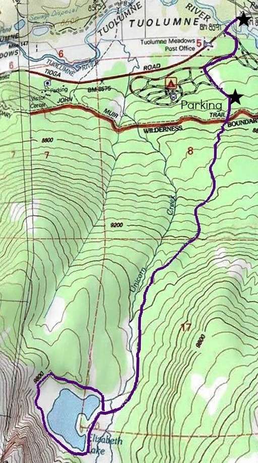
Elizabeth Lake Trail Map, Click for larger version. Orientation: North is up
Elizabeth Lake Hike
Trailhead: in the Tuolumne meadows area of Tioga Road/Hwy 120 the trailhead is located in the very back of the Tuolumne Meadows Campground (map). We parked outside the campground on a pullout, but it appears that you can drive in after talking to the park service worker at the booth. After you get in the campground there are little signs navigating you to the trailhead.
Distance: From the official trailhead: 4.8 miles out and back according to the park. We ended up hiking around the lake after we got there on a unmarked but obvious popular user path, probably adding almost a mile to our hike. Totaling around 6 miles?
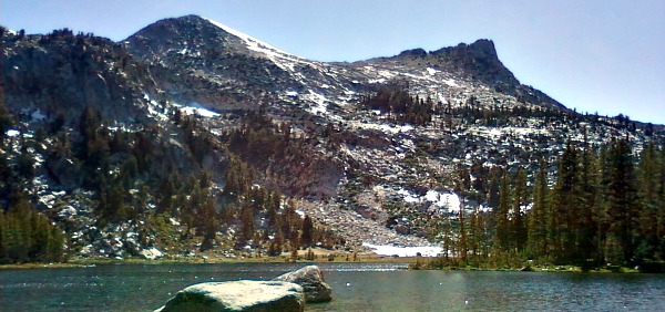
The hike out to the lake is not long, but starts from a high elevation and continues a a mild uphill the whole distance. I think it was the perfect hike for getting back into “High Country” shape, plus the way back to the car is a breeze. The beginning of the hike is located in generic Yosemite woods, but opened up right before you reach the lake onto a beautiful creekside landscape… Unicorn Creekside Landscape!

By the way, Unicorn Peak & Unicorn Creek are amazing names! I exaggerated the spires at the top of the peak (just a little bit?) that I decided was why this mountain was given this name… but do you see it now ;)
After crossing Unicorn Creek, which required us to take our shoes off since (you could probably rock hop in by when the water levels are low), you reach Elizabeth Lakes. It is a beautiful sierra lake complete with tiny fishes and mosquitoes. I suggest to pack a layer or two, at least if you are going in mid-June, because it was both chilly and necessary to keep the blood sucking bugs off.
By following the path around the lake we were able to get views of Johnson Peak, Unicorn peak and a interesting little avalanche prone slope of Unicorn Peak. By wandering out to the last little patch of snow in the avalanche zone we managed to avoid the wettest area of earth, but beware of the possibility the ground might sink to flood your shoe at any given moment on the south side of the lake.
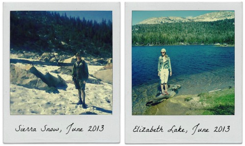
Different methods of trying to not get your feet wet.
Overall Elizabeth lake is a beautiful shorter day hike – Comparable to Cathedral Lake, but with less hiking. Perhaps someday Curtis & I will be back, and have our camera charged for taking nicer pictures. In the meantime check out the gallery below full of shots from our old school phone cameras!


 Hello! I am a 30-something outdoors-lady, backpacker, and resident of Groveland, California -
Follow Me: