
Bagging Peaks and Taking Names: Hiking Mount Dana
There are some trips that Curtis and I have been meaning to do for years now, Lyle Glacier, Mount Lyle, Mount Whitney, anywhere in Sequoia, and Mount Dana. Guess which one we finally crossed off the list!?! (SPOILER: it’s should be pretty obvious by the blog title)
Yep, we hiked Mount Dana last month – which is now officialy the tallest summit I been to.
I don’t think of myself as a peak bagger: I don’t prioritize peak climbs over any other pass/alpine lake/river, I have only bagged a very puny number of peaks, I am a great lakes girl and by god I love lakes! Even so, climbing to the top of a mountain does have a certain allure and I get why so many people start collecting peaks – rare ones, tall ones, beautiful ones.
The blog Hiking Angeles Forest introduced me to the idea of a “Peak Bagger Resume.” Hiking Angeles Forest’s resume currently has 45 peaks and a good explanation of the whole idea. I decided to draw some inspiration and make my own resume… only I have 15 peaks.
Hahaha, 15 peaks? What? Why even bother… except I still love those few peaks I have seen. Why not remember them, right? And with any luck I still have a long time build up my repertoire. You know, like hiking Mount Lyle, Mount Whitney, anywhere in Sequoia National Park…
Click here to see Beaut-tree.net’s Peak Bagging Resume
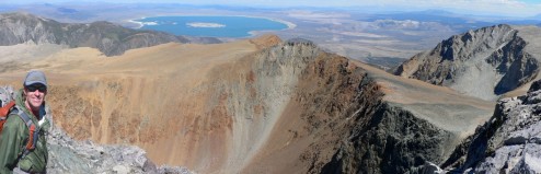
Curtis at the summit of Mt Dana
Hiking Mount Dana
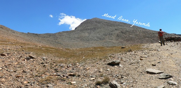
Distance: 6.25 miles roundtrip, up a surprisingly well established unmarked trail. But before you run out thinking “Only 6.25 miles,” like I did, let me tell you this is a steep one. Bring the trekking poles and knee braces.
Trailhead: The trail starts directly outside the Yosemite Park/Inyo Forest border, on the South side of the Tioga Entrance Station. There isn’t a sign, but it should be to the left of the massive brown park gate (if the gate is swung open). We parked in a pullout outside the park off of Tioga Road, but there is some parking inside the park too. Map.
We started up the trail a little bit before noon, after finding out that the trailhead was currently being used a the finish line shoot for the Tioga Pass Run. No matter, we cut across behind the shoot and found the trail easily enough. At the time I felt like our 6 mile hike looked pretty wimpy compared to those people running up the pass. Objectively I now think they have their own challenges.
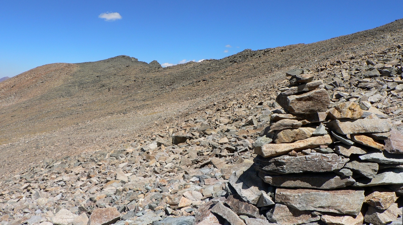
As the day wore on it became increasingly windy, and it was chilly at the summit. Near the peak massive rock towers, looking like cairns made by giants, offered spots to rest away from the wind.
The trail is well used, I saw over a dozen other people hiking up and down from Dana that sunday. It is easy to imagine though that the trail to Dana started out as a use trail that has been improved over time – the super steep sections through the talus are very indicative of a bunch of people just hoofing it toward the destination as quickly as possible.
I admit we did not hoof it towards the destination as quickly as some other groups did. Previously I blogged pictures of the Yosemite Meadow Fire as we saw it grow exponentially on this hike – We spent a good deal of resting time watching the smoke plume grow. Curtis and I stuck it out on the summit long enough to get Mount Dana, and a sweet little wind blocked sitting spot, to ourselves. By the time we walked down the trail it was late enough in the afternoon that the pikas were beginning to become more active – which meant we had to stand around and watch them too (Sorry, Curtis / NOT SORRY AT ALL).
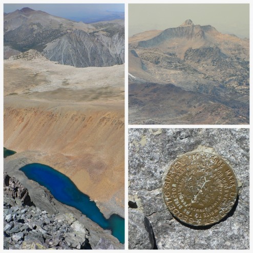
Sights atop Dana (clockwise from left): Lake Dana, Mount Conness, Mount Dana Survey Marker
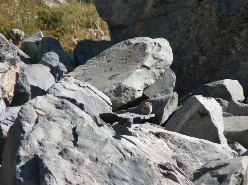
Sights on the way down from Dana: This adorable pika
I was a little sore the next day, but I am glad we finally got to check Mount Dana off the to-do list! More photos below.


 Hello! I am a 30-something outdoors-lady, backpacker, and resident of Groveland, California -
My favorite part about this blog is the name – clever!