
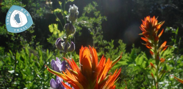
PCT Creekside Camp, Tahoe Rim Trail – Day 5
Click for Map
Beginning June 25, 2014 I thru-hiked the Tahoe Rim Trail (TRT), circling Lake Tahoe in 12 days. Accompanied by my friend and fellow blogger, Trails, we bravely took on this 165+ mile loop. I will be blogging a day-by-day rundown of each day’s hike, night’s campsite, and my contemplations while beating down miles. Check out my complete trip report for the TRT here – This is day 5.
The mosquitoes I tangoed with at Middle Velma Lake on camp night 4 were only a warm-up. The real deal was to be found on day 5, as we exited the Desolation Wilderness and hiked down the TRT to camp besides an unnamed small creek about a mile after Bear Creek.
I am calling camp on night 5 “PCT Creekside Camp” because we did see the most number of PCT hikers passing through here. This was supposed to be a really short day, only traveling to Richardson Lake, but we at least kept hiking until around 4 that day. Stopping early here, on our last night along where the Pacific Crest Trail and TRT overlap allowed us to see a good cross-section of PCT hikers passing though on their trek.
Obviously PCT hikers are hardcore people, they are hiking thousands of miles! But to see how the PCTers calmly handle things like mosquitoes, hauling water for dry camp, calmly contemplating how they might be hiking until 8pm… it is really something else. This trail is their home, and we were just visiting.
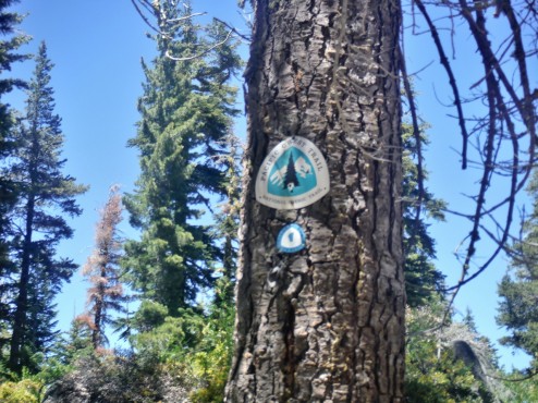
Can you spot the difference between the PCT (top) & TRT (below) trail signs?
Hiking the TRT from Middle Velma Lake to PCT Creekside Camp
Mileage: 13.4 miles. Not much elevation change today, just an overall gradual decent.
Water Sources: Many creeks were still running when we went through, even the seasonal ones. Richardson lake and Bear Creek seem like the most dependable water sources on this stretch.
This stretch of trail is the part pf the TRT I remember the least details about. It was damp, forested, and filled with colorful wildflowers and ravenous desolation wilderness mosquitoes (as well as non-wilderness affiliated mosquitoes). Because of the mosquitoes Trail’s and I power hiked much of the morning, which is probably one reason why everything is such a blur.
We did manage to find a nice spot to take a break at a high point in the trail about a mile before an offshoot trail to General Creek. Views of Rockbound Valley, a break from the mosquitoes, and a chance to catch our breath! Maybe a nice spot to dry camp if you are determined to camp on this less visited side of the Desolation Wilderness?
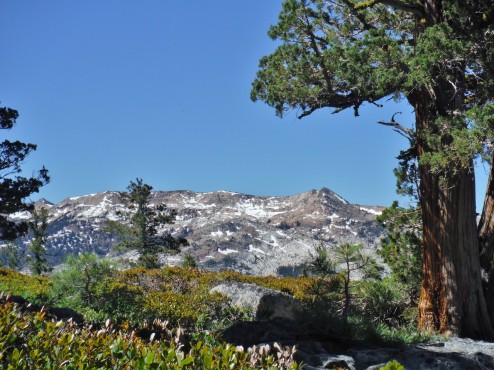
Rockbound valley is behind that beautiful Juniper tree.
As we crossed out of the wilderness and back into multi-use Forest Service land the trail met and intersected with a good number of ORV trails/dirt roads. With actual vehicle use on them too! Too bad nobody appears to be using these roads as an easy way to bring in a saw to cut away the numerous downed trees that block the trail here. None are that hard to get around, but are (as always) just annoying enough.
We had been wanted to stop at Beat Creek for the night but it doesn’t have any obvious camping spots. Instead we filtered water and prepared to dry camp. Dry camping is camping without a water source nearby, meaning you carry enough water for camping and hiking until the next water source. We were concerned about the availability of seasonal creek flows despite the amount of mosquitoes… odd concerns looking back at it, but we were committed to not hiking too far.
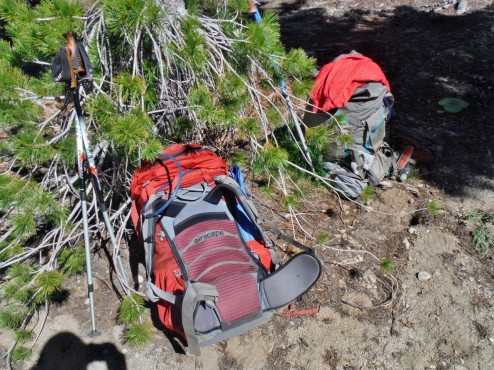
With a few more liters of water these sucker become beasts of burden.
As it turned out, testing our ability to carry enough water to dry camp for one mile was a good idea. In that one mile we realized we should avoid having to carry that much water. We decided to redo our mileage for the trip to get to lakes and streams, even hiking a couple crazy mileage days just to make sure we didn’t have to hoof water up to Mount Baldy. Good to know!
The creek we did end up camping besides was flowing. Here there was an obvious little fire ring and camp area, although the incline of the tents spots did leave something to be desired. Also the campsite featured a bug triple threat: Ants, biting flies, and mosquitoes. After splashing in the delightfully cold creek water and eating we hid in our tent SUPER early. It kept the bugs away, and allowed us to re-plan the mileage for the rest of the trip.
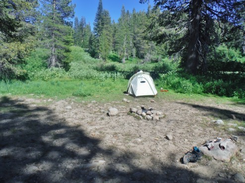
This PCT Creekside camp was not the Hilton of campsites, but it did the job.
The plan for the next day? Wake up with the sun and get to hiking 18 miles to Tahoe City, or as close as we could get and still find a camping spot. Good thing we were prepared to go to bed early.
More photos in the gallery below & continue on to day 6 or find links to all my TRT blog posts in my Tahoe Rim Trail Trip Report.


 Hello! I am a 30-something outdoors-lady, backpacker, and resident of Groveland, California -
Follow Me: