
Pilot Peak, Stanislaus NF: Fire lookouts and mountain bikes
Every time I am down in the Merced River Canyon (that is the Hwy 140 entrance to that park, by El Portal) Curtis points out the Pilot Peak lookout tower standing high above us and says I should go there… you know someday.
But we don’t dare take our passenger cars up the steep final grade to the top, and who wants to walk up to a lookout tower when everyone else is driving? …But since I just got my mountain bike – it was time to check this local point of interest off the list!
Pilot Peak, Groveland Ranger District, Stanislaus National Forest
Trailhead: I parked at the “Five-Corners” intersection off of 2S30, but you could continue further up toward the peak (the road doesn’t get really bad until the reaching the turn off to 2S04). To get to five corners turn onto the eastern side of the Hardin flat road loop from Hwy 12o, then take the first left down the paved Forest Road 2S30. Follow the paved road to the five corners intersection. Unless you have an all wheel drive vehicle and a real sense of adventure I would suggest sticking with 2S04 even though there appears to be lots of options on the map to get out here. map
Distance: 7 miles, 3.5 miles up to the lookout and back down again. On the way out the last mile is the steepest part of the journey. Map
I have heard mythical “Five-Corners” intersection for a long time now… Like a star in the middle of the Groveland Ranger district, the meeting of these five roads has turned into a parking lot sized gathering place from which a wanderer head out towards the Bower Cave area, Pilot Peak, Hazel Green, or even Trumble Peak or Mariposa if one is patient enough. 2S30, the road out here, is actually great for passenger cars, and offers many crazy Rim Fire logging viewscapes if you are interested in seeing that side of forest operations.
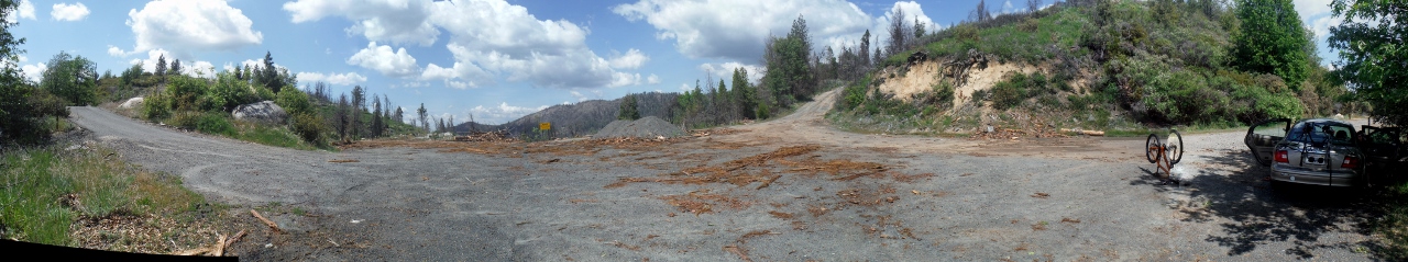
Five Corners, Stanislaus National Forest
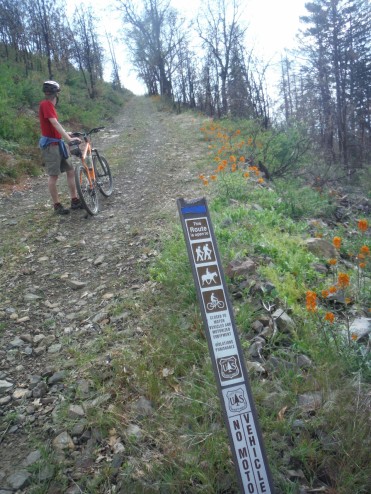
After parking at five corners head towards the northwest most road, there is a sign designating this as the route to Pilot Peak. There was a good deal small dead wood on the ground from tree cutting here, but soon enough the road passes the edge of the Rim Fire boundry.
Stay left at the first fork and continuing pedaling uphill. At the next intersection, a bulldozed area, take a sharp right onto 2S04. This is the start of the heart pounding switchbacks that quickly gain ground up to the summit. We biked this in the beginning weeks of May, and the gate just prior the peak was closed. We throw the bikes over and continued up to the top.
Thanks Forest Service for assuring us the bikes are allowed past the gate!
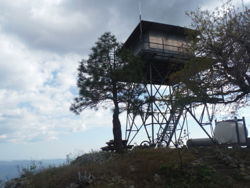
At the summit you will find the Pilot Peak Lookout Tower, which is still currently used as an outpost in the summer fire season. The original tower, which looked like a cabin the pictures online, but must have burned down at one point (?) – it is now a standard modern tower. Don’t expect to get to the top, it was locked up, perhaps better luck when a an spotter is being employed in the summer?
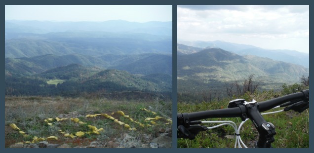
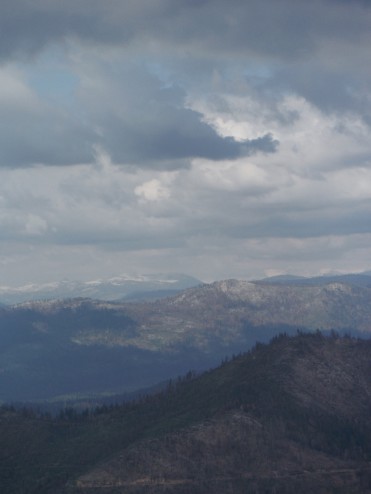
In the odd burst of weather that was happening that day the clouds hung low obscuring views of the furthest peaks for us, but it was still a nice nest from which to see down into park and out to the Sierra National Forest. Although not too far from home I am unable to name most of the Sierra National Forest highspots we were looking at. Better start learning for the next trip!
Obviously it is an easy bike back downhill to the car. Just be careful not to gain too much speed before hitting that gate near the tower!
.jpg")
.jpg")
.jpg")
.jpg")
.jpg")
.jpg")
.jpg")
.jpg")
.jpg")
.jpg")
.jpg")
.jpg")
.jpg")


 Hello! I am a 30-something outdoors-lady, backpacker, and resident of Groveland, California -
Follow Me: