
Glacier Point to Illilouette Creek – Backpacking Red Peak Pass Day 1
Map of Loop
Curtis & I hiked Red Peak Pass in Yosemite for 5 days and 4 nights. It was 50 miles of mountains, lizard push-ups, rivers, and lakes. Check out the blog post detailing each day’s ups, downs, and tips: Day 1, Day 2, Day 3, Day 4, Day 5
Or continue on to read of day 1’s adventures…
Something Curtis and I are really horrible at is getting starting hiking early. Unless if we are in a group of go-getters, traditionally we will start our hike no earlier than 10am, but realistically around 1 or 2 in the afternoon. I think it is because even if we wake up at an “early” hour we still need to prepare our pets for when we leave, double check everything, eat a fairly decent “last” breakfast, and drive. Additionally, on this particular trip it was the fourth of July in Yosemite and we were going to Glacier Point… which I would like to think of as the Magic Mountain of Yosemite (the Valley is of course Yosemite’s Disneyland). Right, so we started hiking at about 1pm.
Luckily having only planned 8 or so miles in the first day this wasn’t too bad, and the majority of walk through this stretch was downhill, working your way up Illilouette Creek. And, once we passed the turn off away from Illilouette falls and the panorama trail we did not see a single person for the rest of the day!
There was one river crossing on the first day that required taking off our shoes and wading about knee deep, which may have been tricker in higher water (bring trekking poles for support?). Along the 1.6 miles of trail after crossing the creek (see National Geographic’s Yosemite SW Map) we ran into the first area of tree fall from the windstorm that happened up here last winter. I wonder if/when the park will get around to moving these guys off the trail. At the end of the 1.6 mile stretch though, right as the trail hits another, there was a fairly fantastic tree that fell directly on the mileage/direction sign, hammering it into the ground. Good aim tree!
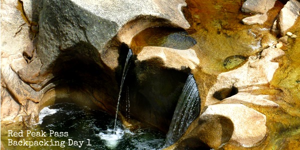
Per the goal, we hiked off of our Yosemite SW map, onto the Yosemite SE Map. We stopped as we reached a flat where we met up with creek again in the woods. There were a few pre-impacted sites with campfire rings, and it was not very buggy for being right next to the creek. A pretty solid first day – see the pictures below


 Hello! I am a 30-something outdoors-lady, backpacker, and resident of Groveland, California -
Hello. Not certain if you check this blog but what was the name of the trail head you started at? Thank you.
Hi John, Using the wilderness permit map the trail is called “3B. Glacier Point to Illilouette” See: https://www.nps.gov/yose/planyourvisit/upload/wildernesstrailheads.pdf
Thank you very much
Do you have any photos of your first day creek crossing? We’ll be there first week of July and I want to get an idea of what we’ll be up against.
Thanks!