
Although it might be a month too late for New Years resolutions, I am still resolving to figure out how to get in shape for hiking season this month – & then to achieve awesome hiking fitness before the summer backpacking season begins! I am calling it Fitness February, and you can follow me in figuring out what will really physically prepare a hiker hitting the trail strengthened and pain free. What exercises should hikers do?…

For the last 9+ weeks (in theory 9, but Chirstmas and a stomach flu happened in that same time frame, so you know…) I have challenging myself to follow a Couch to 5K program. A Couch to 5k program, if you are not in the know, is a gradual way to take yourself from being a lazy couch potato and turn you into a 5K racer. Which may seem weird for me because…
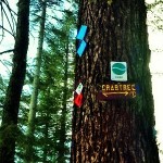
You know how you know you are on a real adventure? You travel one whole pass up the mountain! That is right, we traveled all the way over to Hwy 108 / Sonora pass to cross country ski Dodge Ridge. First skiing trip of the year, meets first winter trek outside of Hwy 120, meets first first trip to Dodge Ridge. Just kidding (about the whole “Real adventure“, and “One…
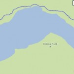
Just a quick little blog post to announce my new Yosemite Day Hikes Blog Map. I have been dreaming of putting together this map forever and finally got around to actualizing it today! The map shows information about all the Yosemite day hikes I have blogged about in the past, with links to the posts & provides a brief summary of the hikes below. In addition, when you click on…
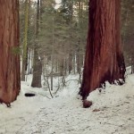
Our trip snowshoeing the Merced Grove of Giant Sequoias allowed us to travel off trail to see a few of the Sequoias you can only peer at in the summertime.

Last Saturday Curtis and I with some friends made the trek down to San Francisco to do some pre-gaming with the other dozen Packers fans by the stadium. It was the Green Bay Packers versus the San Francisco 49ers for a post-season game, if you are blissfully out of the know. The plan was to then head out to a bar to actually watch the game, since tickets were pretty pricey every time we checked. Of course once we…
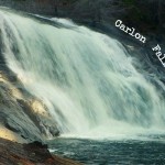
Trailhead: Evergreen Rd, Stanislaus National Forest – after bridge on South fork of Tuolumne River/ Opposite side as Carlon picnic area sign!
Distance: ~ 3.5 miles out and back. Trail is fairly level at first and then goes over a couple large hills right before reaching the falls.

So there for a while, my CSA box was always full of cucumbers. And I love cucumbers- as a snack with peanut butter, chopped up into a salad, made into pickles…. but eventually I ran out of ideas. And the cucumbers kept stacking up in my fridge, mocking my lack of imagination. Thankfully, Heidi came to the rescue.
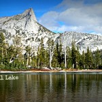
Trailhead: Tioga Rd / Hwy 120, on the West side of Tuolumne Meadows by the Cathedral Lakes sign. Parking here is pullout/parallel and usually a mess so you should see the line of cars as you approach.
Distance: ~7 miles (out and back). climbing mostly in the hike “out”, & descending in the back “back”


 Hello! I am a 30-something outdoors-lady, backpacker, and resident of Groveland, California -


Follow Me: