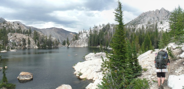
Backpacking Crown Lake: Herbert Hoover and Day 1 of Independence Day 2016 Trip
Fourth of July 2016: Another Independence Day and another backpacking trip into the Hoover Wilderness on the Humboldt-Toiyabe National Forest. But of course, on one of the busiest backpacking weekends in the Sierra Nevada we returned to the place where wilderness permits are moderately easy to obtain. But maybe, perhaps subconsciously, I was also returning on the 4th of July to the wilderness named after the 31st president of the United States. How American!
The Hoover Wilderness is named in honor of president Herbert Hoover, who was incumbent at the time this land was set aside in 1931 (since the land was set aside before the wilderness act was signed into law in 1964, the area was originally a called a “Primitive Area”). It occurred to me this week that I know very little about Herbert Hoover as a president, despite quite a few trips past the Hoover Wilderness boundary sign.
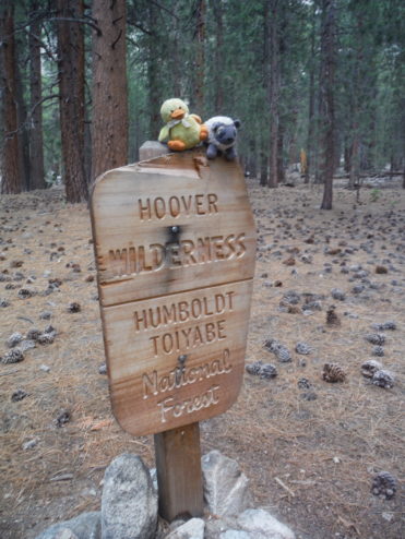
Herbert Hoover was the 31st president of the United States, engineer, Midwestern born, Stanford educated, and apparently pretty easily overlooked in my American history classes. He was sandwiched between the roaring 20’s Calvin Coolidge, and new deal’s Franklin D Roosevelt. In fact, one might liken it to being sandwiched between the more famous Yosemite and Ansel Adams Wildernesses?
I am not a presidential scholar, nor here to bring judgement of Herbert Hoover’s legacy as a president. I am, however, a frequent hiker of the Sierra. In that capacity I think Hoover is a winner. But, despite my proclivity for early July Hoover trips, may I suggest a visiting the Hoover outside of mosquito season?
Day 1 of 2016 Independence Day Sierra Backpack – Barney Lake, Robinson Lake, and Crown Lake
Trailhead: The Robinson Creek Trailhead starts out of the far end of the Mono Village Resort. Getting to the Mono Village Resort is easy – after picking up a permit from the Bridgeport ranger station travel into the town of Bridgeport, then turn left onto Twin Lakes Road – once you reach the resort things become more chaotic. On the 4th of July weekend it was a complete cluster of human beings everywhere. We parked, waited to get a parking permit ($10 or $15?), & obtained very vague information about how to reach the trailhead.
A small Barney Lake sign on a tree initially pointed us down the road straight across from the entrance booth. We blindly followed yellow marker tags on the trees – avoiding kids, dogs, roots, and questionably parked vehicles. The objective is to to reach a green grassy meadow like area with a large authorized vehicles only/No Vehicles type sign on a fire road to the right. Down this road is a metal rope to block traffic, easily walked around, up to another Barney Lake trail sign forking right just before crossing a bridge.
From here you are officially outside the slice of America that is that overfilled RV resort on the 4th of July, and on a forest service trail. I’m still not sure where we were supposed to park. Considering it was so crowded no one noticed one more small car in the fray. Map & Good luck!
Distance: 10.5 miles from Mono Village Resort to Crown Lake, 2600 ft accent on day one. 8 miles from Crown Lake to Peeler Lake via Kerrick Meadow, 1400 ft accent on day two. 8 miles from Peeler Lake back to Mono Village Resort, only 250 ft accent on our final day of hiking down and out. (Reports for the following two days soon).
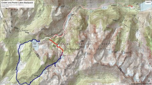
Robinson Creek Backpacking Topo Map. Day one is in Red, day two blue, day three white. Click for full size
After escaping from the RV resort, me, Curtis, and our friend Will, started up the trail at 11:30 AM. We could have started sooner if we didn’t do 4 laps around the RV park while wondering how many RVs could possibly fit here… and why? Why no trail signage, why no parking signage, why were there people parked down the ‘no vehicles’ road? Could we? Should we?
The trail follows a familiar eastern Sierra Canyon pattern – a dense forest, aspen stands, then open fields with vistas of the surrounding mountains. Many day hikers on this trail will enjoy this section with you as they hike the 4.5 miles up to Barney Lake. Barney Lake is a beautiful resting point about 1000 ft up the climb. It is also the first time the mosquitoes started coming at us with some intensity.
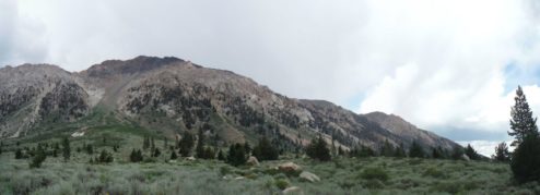
Views of the Robinson Creek Canyon. We were running from thunder clouds the first day. They never caught up.
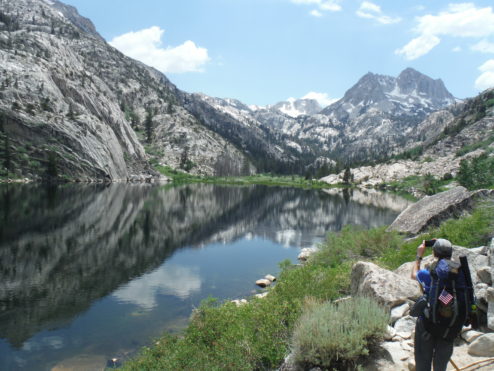
Picturesque Barney Lake
From Barney Lake we crossed the Robinson Creek, twice in a half mile stretch. Luckily the rushing waters were not as alarming as they looked below Barney Lake, but I do suggest that early season hikers bring river crossing shoes they are confident in and trekking poles. On our return trip our group did not change out of our river crossing sandals after the first crossing to save time.
After seemingly endless switchbacks the fork in the trail between Peeler and Robinson/Crown Lakes arrives after mile 8. Robinson Lakes appeared after a very quick half mile past the fork. Note that Robinson Lakes have some very nice looking camping spots. By the time we had arrived many other hikers had taken advantage of the prime spots at that time so we continued onto Crown Lake.
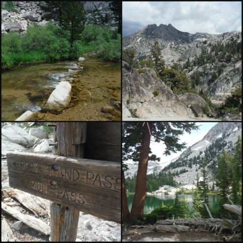
Hiking on up – to Crown Lake!
Crown lake is located with beautiful views of Slide Mountain and surrounded by rocky ridges. The scenery was accented with a layer of snow, which made finding a campsite near the lake even more difficult. “Camping Prohibited” signs filled all of the impacted sites we had found. After a long search we settled on a large site just outside of the lakes perimeter with views of Crown Point.
At this point there was no escaping the mosquitoes. Donning DEET, head nets, and long sleeves we decided to embrace the situation. A army of blood sucking parasites aren’t going to stop us from enjoying some wine out in the open air and watching the sunset. At least, attempting as much enjoyment as possible… Still can’t entirely recommend early July sierra hiking to others.
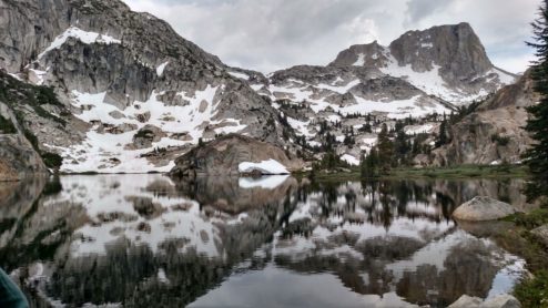
Crown Lake
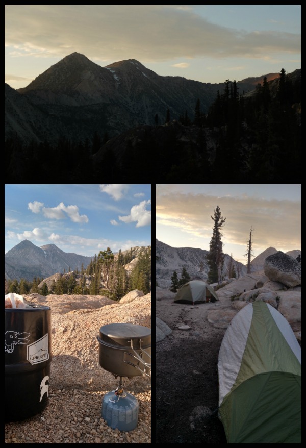
Calmer moments at camp, when the wind picked up the the mosquitoes were briefly at bay.
On Day two we continued over Rockbound Pass and into real mosquito land in Yosemite’s Kerrick Meadow. To be posted shortly!


 Hello! I am a 30-something outdoors-lady, backpacker, and resident of Groveland, California -


Oh man, I’d eat up a Hoover sandwich right now!