Eagle-Shawmut Mine: A Hidden History Except in Years of Drought
2014 has been a heck of a drought year in California and not one farmer, environmental group, or politician is happy about it. We are trucking fish to try and keep them alive, proposing a $14.4 billion dollar bond measure, and looking at all the ways we can conserve and reuse our limited supply. It is a mess.
But while visiting Groveland’s best coffee shop, the Mountain Sage (which really knows how to make lemons into this delicious strawberry lemonade), Curtis learned about another consequence of the drought in our local area: The emergence of old mining relics from beneath the Don Pedro Reservoir.

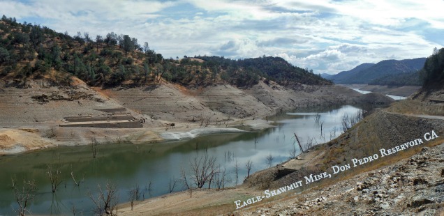
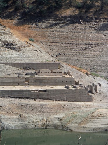
There she is, The Eagle-Shawmut Mine. I do wish someone had been walking around for scale.
Don Pedro is a sprawling reservoir fed by the Tuolumne river. It provides water for Modesto and Turlock area farms, residents and sometimes even feeds into San Francisco’s water supply system. The Old Don Pedro Dam was built in 1923 and offered 289,000 acre feet of storage (reference), but by the late 1960’s it was decided that this wasn’t enough storage. The new Don Pedro dam was constructed 250 ft higher than the old one, enlarging the reservoir to 2,030,000 acre ft of storage. In the process of enlarging the reservoir we drowned the Old Don Pedro Dam, the town of Jacksonville, and a series of gold mines.
It is odd to imagine what it would be like to be forced out of your home and then see houseboats floating above it’s memory some years later. The San Francisco Bay Area Television Archive has footage of Jacksonville in the year (months?) before the dam was completed – and it feels very ominous. Today the only time anyone talks about “Jacksonville” is when referring to Jacksonville road which bridges over reservoir near the old town or maybe if you stop to read the odd roadside historical marker.

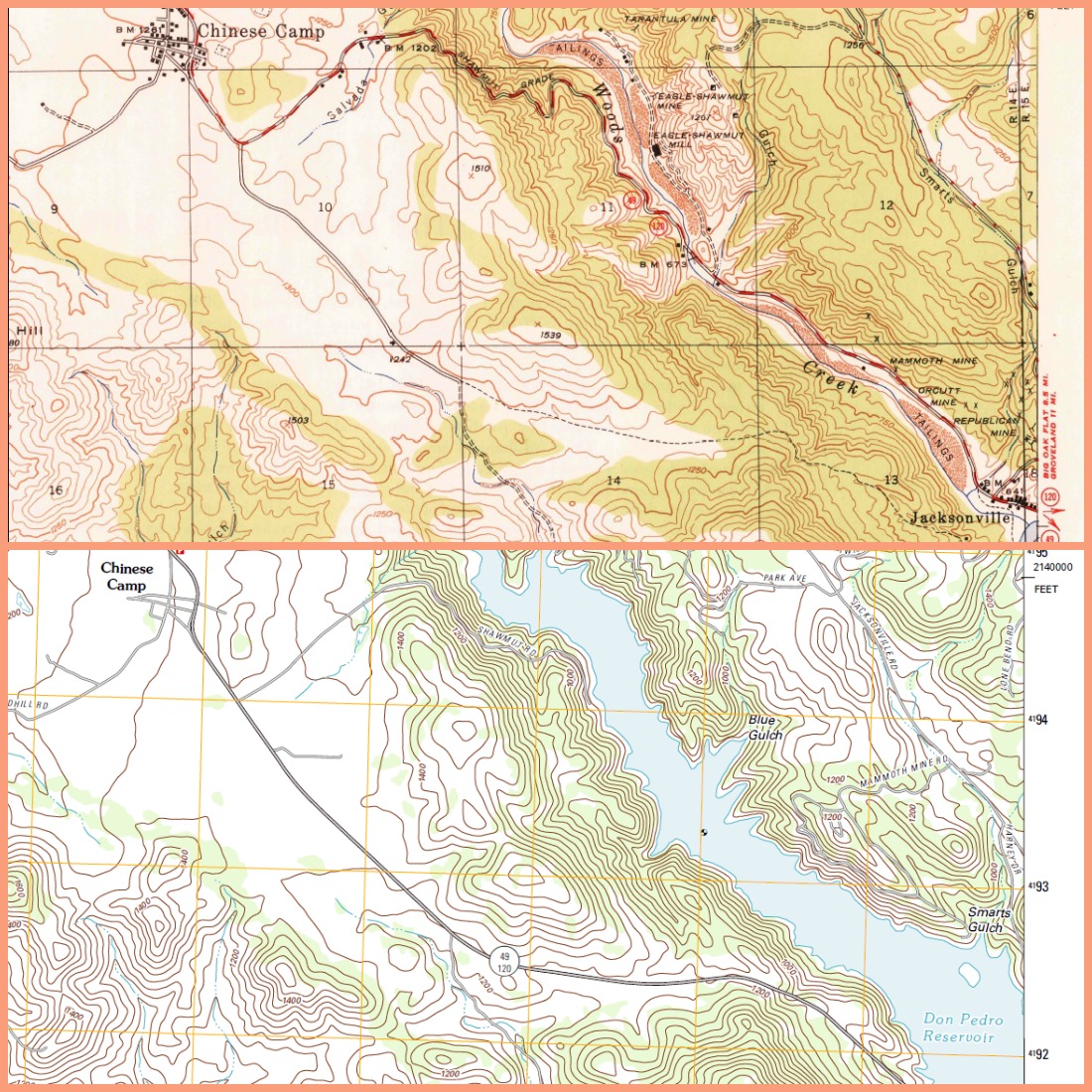
Here is a side by side of the 1948 USGS Topo Map with the mine and Jacksonville on it and the 2012 USGS topo map showing this area today. Click image to enlarge.
Eagle-Shawmut Mine, Chinese Camp CA
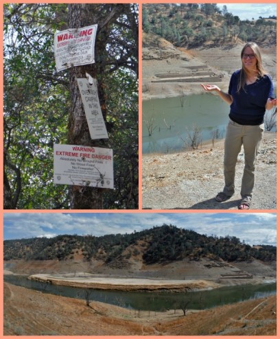
Directions: Driving west out of Chinese Camp on Highway 120 look for Shawmut Rd on the left side (towards the reservoir) and follow this paved road to it’s end to park. From the parking area you can look across the way to the main mine site, or explore down the old road slope at your own risk. Map
When Don Pedro is drawn down enough, as of Oct 13th Don Pedro is at 37% capacity, the relics of the Eagle-Shawmut Mine begin to emerge from the water. Without vegetation to block the view the mine juts out from the bathtub rings of drained reservoir. Some people kayak over to the main building, carefully avoiding ghost trees on the reservoir bottom, but I was happy simply observing from across the way.

Time spent under water has aged the mine giving it the look of an “ancient relic,” even if it is only from the pioneer days. Eagle-Shawmut Mine operated from 1897 to 1942 (ref). That means this mine was closed for almost 30 years before the New Don Pedro Dam was built. It has been 43 years since the new dam was built, and as far as I know the mine has been under water for most of those forty plus years.
Hopefully soon the mine will once again be submerged after the drought ends and reservoir levels rise. In the meantime it was fun to check it out and learn a little more about local history.


 Hello! I am a 30-something outdoors-lady, backpacker, and resident of Groveland, California -


That’s the foundation for the Eagle-Shawmut Mill. The mine itself was on the backside of the hill near Jacksonville Rd. The ore was transported by a tramway system and the 100 stamps were powered by a water.