
West Side Trail: Where the History of Logging, Railroads, and Taco Bell Intersects
Working with people who have lived in Tuolumne County for many/all of the years of their lives results in lots of impromptu history lessons. Like someone will casually mention Mr Bell’s ill fated railroad Amusement park in the City of Tuolumne. You know, like Mr. “Taco Bell”, franchise restaurant owner and railroad affectionado… No I don’t know, but you bet I was about to find out!
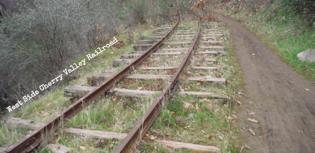
The West Side Cherry Valley Lumber Company hauled logs into Tuolumne City via the last Western narrow gauge logging railroad from 1889 until 1961. The logging company ultimately cut railroad operations in favor of nimble and cheap trucking. This left an abandoned railroad (with equipment) prime pickings for wealthy railroad aficionados… like Glen Bell, the founder of the Taco Bell, a man with a dream of an amusement park of equal parts rides, history, and local recreation… and a non-branded mexican restaurant
It’s hard to imagine the man who created the Enchirito packing up his bags with dreams of opening up an amusement park in Tuolumne today. It’s a bit out of the way from everywhere, an area built by the lumber products that supported it’s economy. Despite the odd location for an amusement park Glen Bell bought the area in 1968.
In my mind quaint amusement parks, like this one, are very tied to this era of time. Unfortunately the economics of rarely worked in the long run, so all we are left with are stories about what was – or what could have been. The West Side Cherry Valley Park was only open a short period of time, and never reached it’s full potential as a roadside attraction. Alas, I am too young (and too new of a Tuolumne County resident) to have seen this short lived tourist trap. Instead I only could dream of lazy railroad rides and Crunchwrap Supremes as I walked down the West Side Trail.
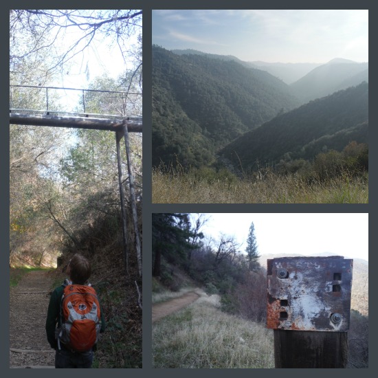
Odd overhead pipes, foothill river canyons and historic railroad markers.
West Side Trail, Tuolumne CA
Trailhead: Take Tuolumne Rd to it’s end, past the intersection for Black Oak Casino, and run left on Carter Street, and Right onto Buchanan. There is a parking area shortly up the road on the left. Map
Distance: Curtis and I walked about 5 miles (2.5 out and back), but the trail goes on much further (4.7 miles out is “Developed”). I think it is even possible to follow Forest Service Rds and meet up with the Railroad Grade even further out. (the original RR had 72 miles of rails)
Today the West Side Cherry Valley area is owned by the Tuolumne band of Me-Wuk Indians, who is planning to build homes and a golf course interspersed with some of these historic railroad items they acquired in the sale, and the Forest Service, who own the land the majority the old grade is on. The path follows the old railroad grade into the Stanislaus National Forest and offers a gentle hike and occasional view of the North Fork Tuolumne River Canyon.
Apparently it’s a big hit among families in the area . I wasn’t expecting quite so much traffic on the trail, but it was a beautiful Sunday, and everyone was in a good mood. Actually this is probably the busy season for the trail. During the fall, and our current mild (sauce) winter, the poison oak loses it’s leaves – so it’s numerous bushes are less likely to invade your space – and midday temperatures are perfect for stroll. The only thing this trip was missing was some Taco Bell… Next time.
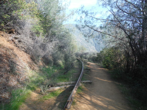
Rails appear along the walked path a little ways in, and occasional very informative historical signs are interspersed through out.


 Hello! I am a 30-something outdoors-lady, backpacker, and resident of Groveland, California -
It wasn’t economics, per se, that ended Glen Bell’s amusement park. Mr. Bell closed the park after learning that his general manager, a person he had trusted, had been embezzling funds from him.
How scandalous! And pretty disappointing if that is the reason we don’t have a historic amusement park today. I would have loved to see the place.