
Skiing the El Portal Fire – Snow, Fire, & Historic Yosemite Railroads
Last winter on my first/only ski of the season I traveled through the Rim Fire area to reach the Rockefeller Grove. This year for my first ski trip of the season (but hopefully not the last!), Curtis suggested we take a short little trip in the area of Crane Flat affected by this summer’s El Portal Fire.
The El Portal fire lasted from July 26th until August 10th this last summer, burning just under 4700 acres. It wasn’t a big fire, but it did cause some traffic restrictions on Highway 140, filled the valley with smoke, and briefly threatened the Merced Grove of Sequoias. Curtis helped out with this fire, both the parts on the Stanislaus Forest and in Yosemite. Apparently he had driven down this road we were skiing on while evaluating dozer lines.
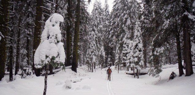
An Easy Quick Cross Country Ski out of Crane Flat Campground, Yosemite
Trailhead: In years past Crane Flat campground has been plowed and the gate is opened up to make a “Snow Play Area” – allowing easy parking and access for trails out the area. This was not the case when we visited a weekend ago – we instead parked at Crane Flat Gas Station and walked over to the campground. Map
Distance: It was a short trip – I think only a half mile down into the campground and then another half mile down the old fire road. I think we skied a total of 2.5 miles after exploring the campground and travelling back out again.
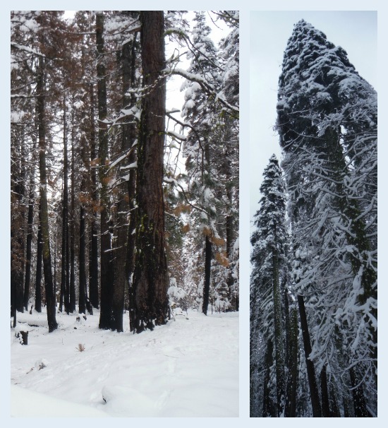
El Portal Fire Scarred Trees
It isn’t exactly the most poetic name, one could also refer to the Trash Bin Out and Back because this fire road starts just past where Yosemite keeps all the Crane Flat Campground trash bins (at least during this winter). This isn’t as scenic as the advertised trail out to the Clark Range viewpoint (which I full heartedly recommend for those wanting a longer ski).
As it was we wanted a nice warm up ski – something short to stretch our skiing muscles. Also it allowed for Curtis’s ski bindings to finally kick the bucket without have to tromp too far in the snow to get back to the car. We really need to get those fixed soon, or risk this really being the last trip of the season!
The road dead ends at a little meadow and hillslope where Curtis says an old logging railroad used to operate. There isn’t a super detailed map of the area, but over on the yosemite.ca.us library the book Yosemite: the Park and its Resources (1987) by Linda W. Greene has a map of the Yosemite Lumber Co. Rail Road which could traverse this spot if you extrapolate it on to the same approximate location.
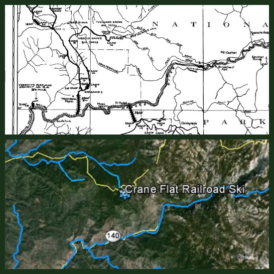
Obviously this old map is 1)Not very detailed, and 2)Not drawn to an exact scale – but it does seem possible that we could have been near the Camp 16 location. Top: Map source Bottom: Google Earth
While I sometimes don’t think of it while in the high Sierra, Yosemite’s history of railroad, logging, and fire have all played an important role in shaping the park today. This is not the most epic ski, but it is a nice little winter adventure to discover a less visited corner of the park.


")


 Hello! I am a 30-something outdoors-lady, backpacker, and resident of Groveland, California -
Follow Me: